|
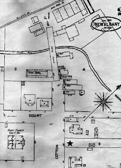
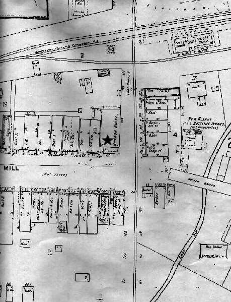
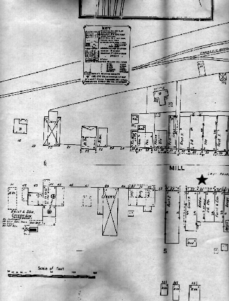
Map #1 is a map of the eastern end of downtown. To help you get your bearings: The black star on the map denotes the present day location of the Bank of New Albany, directly across the street from the courthouse. Don't let that long wooden bridge shown at the top of the map throw you off! Map #2 shows the main downtown area. The black star on the map shows the location of the present day City Hall. Hasn't changed all that much in the last 100 years has it? Map #3 shows a portion of the western end of downtown a little farther down the hill from map #2. Elsewhere in the Union County site is a photograph of downtown taken around 1900. I believe the photographer was standing in the area of the black star and looking to the right when that photograph was taken. The map itself mentions a hardware store directly below the star's location. |